
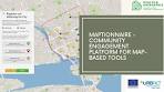
Welcome to Maptionnaire: Revolutionizing Community Engagement
Maptionnaire is a cutting-edge online platform that is changing the way communities engage with urban planning and development projects. By combining interactive mapping technology with user-friendly surveys, Maptionnaire empowers citizens to have a direct impact on the future of their neighbourhoods.
With Maptionnaire, users can easily navigate through maps of their local area, pinpoint specific locations, and provide valuable feedback through customised surveys. This innovative approach not only makes it convenient for residents to participate in decision-making processes but also ensures that their voices are heard and considered by urban planners and policymakers.
One of the key strengths of Maptionnaire is its ability to gather diverse perspectives from a wide range of stakeholders. Whether it’s identifying areas for improvement in public spaces, suggesting new amenities, or highlighting concerns about traffic flow, Maptionnaire facilitates meaningful dialogue between residents, developers, and local authorities.
By harnessing the power of geospatial data and community input, Maptionnaire helps create more inclusive and sustainable urban environments. The platform promotes transparency, collaboration, and accountability in the planning process, ultimately leading to better-designed cities that reflect the needs and aspirations of those who call them home.
Join us on this journey towards more participatory urban planning with Maptionnaire. Together, we can shape vibrant communities that thrive on the collective wisdom and creativity of their residents.
Top 5 Tips for Optimising Your Maptionnaire Surveys
- Ensure to provide clear and concise instructions for participants using Maptionnaire.
- Customise the design of your map-based survey to match your branding or theme.
- Use skip logic in Maptionnaire to tailor the survey flow based on participant responses.
- Regularly test your map-based survey on different devices to ensure optimal user experience.
- Analyse the geospatial data collected through Maptionnaire to gain valuable insights for decision-making.
Ensure to provide clear and concise instructions for participants using Maptionnaire.
When utilising Maptionnaire, it is crucial to offer clear and concise instructions to participants. By providing straightforward guidance, users can navigate the platform with ease and understand how to contribute effectively. Clear instructions not only enhance user experience but also ensure that participants can provide accurate and valuable feedback, ultimately leading to more informed decision-making in urban planning and development projects.
Customise the design of your map-based survey to match your branding or theme.
Enhance the visual appeal and brand consistency of your map-based survey on Maptionnaire by customising its design to align with your branding or chosen theme. By incorporating your logo, colours, and visual elements into the survey interface, you can create a cohesive and professional look that reinforces your organisation’s identity. This level of customisation not only enhances user engagement but also strengthens brand recognition, making your surveys more memorable and impactful for participants.
Use skip logic in Maptionnaire to tailor the survey flow based on participant responses.
In Maptionnaire, utilising skip logic allows for a more personalised survey experience by adjusting the flow based on participant responses. This feature enhances user engagement and efficiency by directing participants to relevant questions or sections, streamlining the survey process and ensuring that respondents provide targeted and meaningful feedback. By tailoring the survey flow to individual responses, Maptionnaire maximises data accuracy and quality while offering a user-centric approach to gathering valuable insights for urban planning and development projects.
Regularly test your map-based survey on different devices to ensure optimal user experience.
To ensure an optimal user experience on Maptionnaire, it is essential to regularly test your map-based survey on different devices. By conducting tests across various platforms such as desktop computers, tablets, and smartphones, you can identify any potential issues related to responsiveness, usability, or compatibility. This proactive approach not only helps in delivering a seamless and user-friendly survey experience but also ensures that participants can engage effectively regardless of the device they are using.
Analyse the geospatial data collected through Maptionnaire to gain valuable insights for decision-making.
Analyse the geospatial data collected through Maptionnaire to gain valuable insights for decision-making. By delving into the data gathered from user interactions on the platform, urban planners and policymakers can uncover trends, patterns, and preferences that inform strategic decisions about city development. Utilising this geospatial information allows for a deeper understanding of community needs and priorities, enabling more informed and targeted interventions that resonate with residents. Harnessing the power of geospatial data through Maptionnaire transforms raw information into actionable knowledge, driving effective decision-making processes that align with the aspirations of local communities.